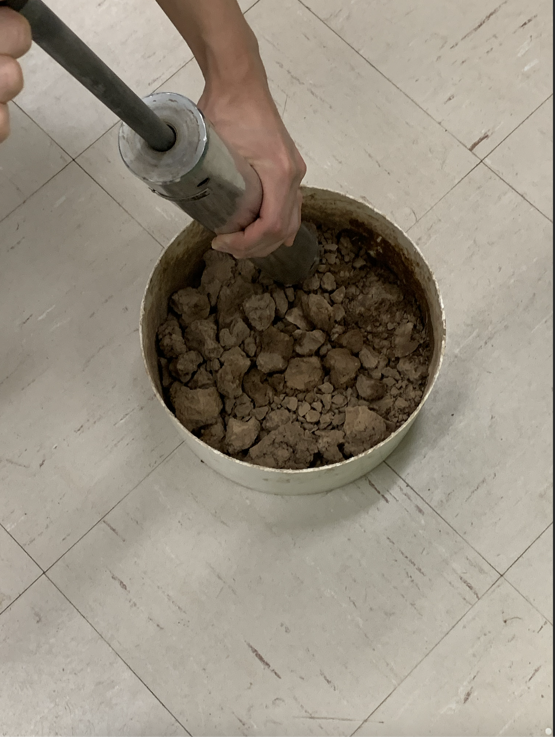
Geotech lab: Soil Compaction
The purpose of this lab was to measure the degree of compaction in a particular soil using the standard compaction method with different levels of water. In the picture, you can see that the compaction test was conducted with the standard compaction hammer. In a group of 3, we were tasked with compacting the soil with a standard hammer 25 times and collecting several soil samples to be placed in an oven, dried and weighed a few days later. This was to check the water content within the soil samples, as there was varying water content added to the soil. Compaction tests are especially useful in construction as it assists in providing insight into the foundation needed for a structure.
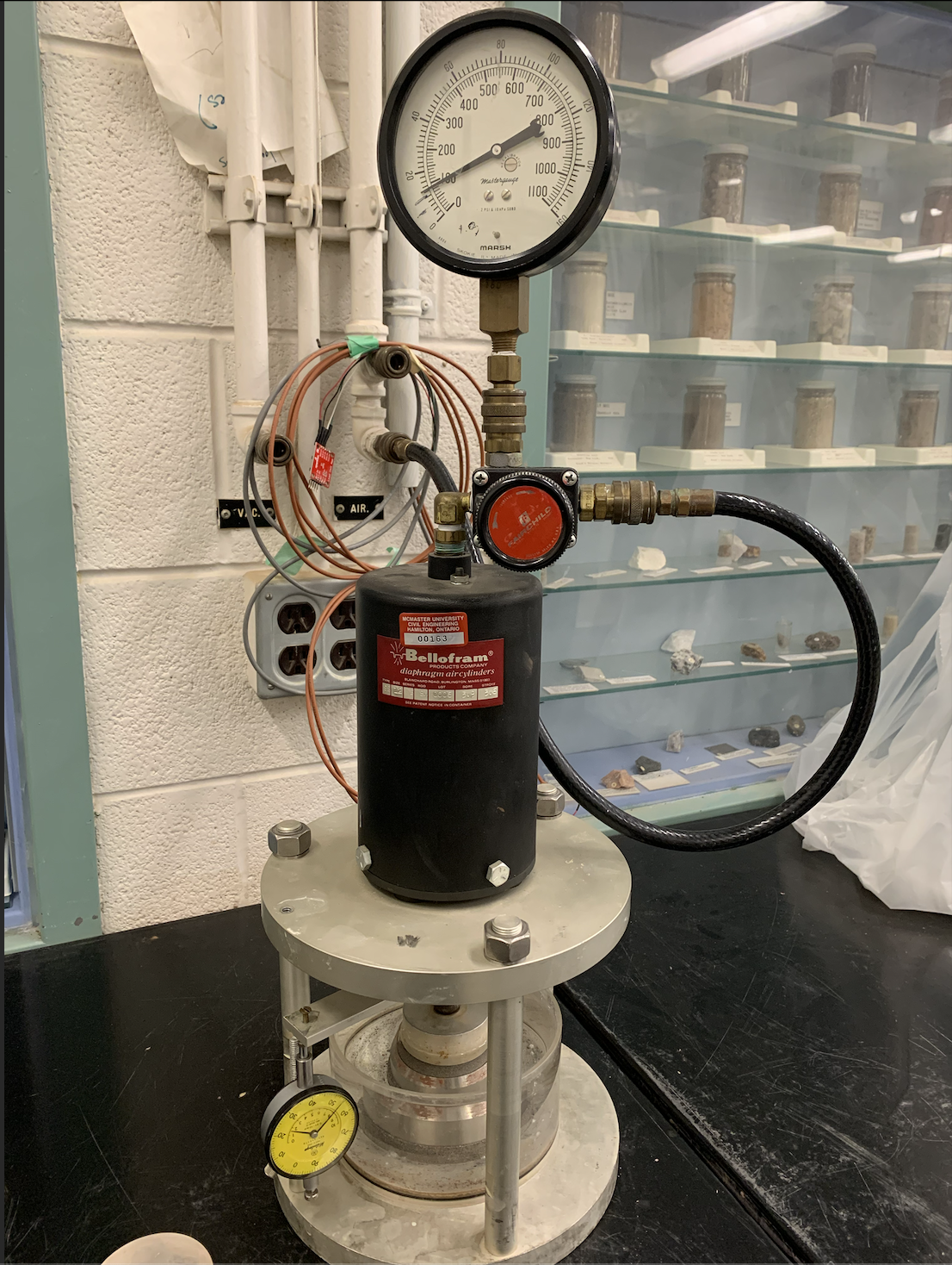
Geotech lab: Soil Consolidation
The purpose of this lab was to observe excess water being expelled and to calculate various compression ratios with the soil sample. In the picture, you can see the air loading system. This is essentially a sample of clay placed into an air piston in a container with water. The dials shown in the picture are the pressure of the air changing which are known as gauge readings. While working in a group of around 10, we were to observe the gauge readings over 8 days then analyze the trend. Soil consolidation is important in construction as it provides a stability analysis for any columns built on clayey soil.
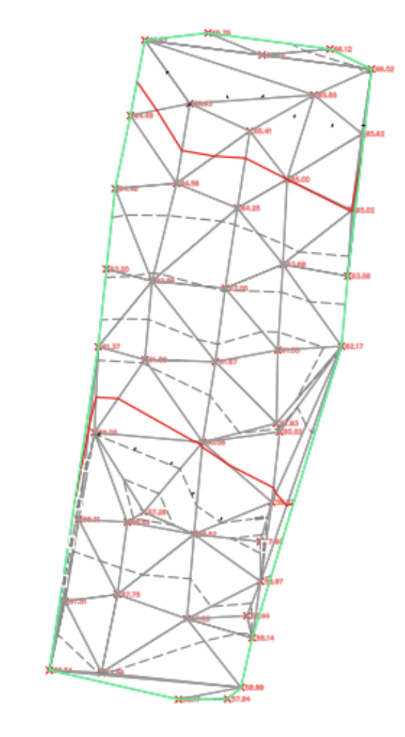
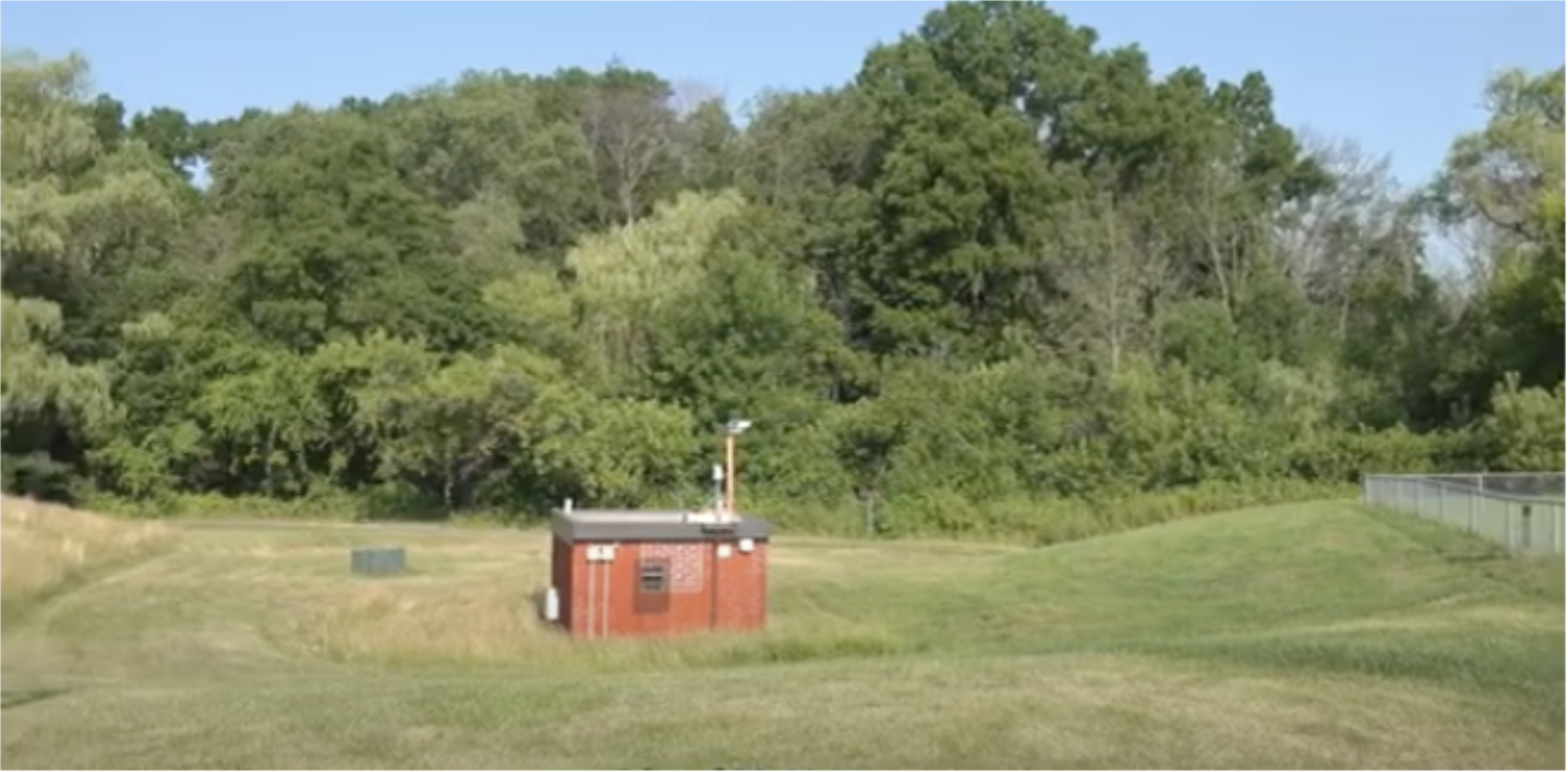
Surveying lab: Topographical survey
The purpose of this lab was to survey a plot of land in order to choose an appropriate access route to a facility with minimal disturbance. Through utilizing Civil 3D, I was able to conduct a topographical survey of the area with contour lines, essentially creating a map of the lot to provide the most appropriate access route. Below, is a picture of the plot of land that was being analyzed. The map that was created on Civil 3D, was generated through coordinates that were given, based on the plot of land.